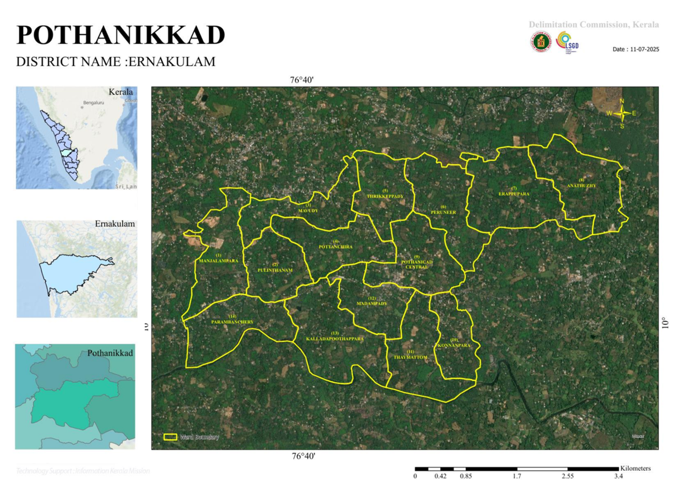
Map - 2025
Government of Kerala | Local Self Government Department
Map & Ward Delimitation 2025
Pothanicad Grama Panchayat
Ward Boundaries and Delimitation Information
Pothanicad Grama Panchayat Ward Map
Explore the ward boundaries and geographical layout of Pothanicad Grama Panchayat using the map below. The map service may provide ward locations and boundary information to help citizens identify their respective local areas.
Ward Delimitation – 2025
Ward delimitation determines the geographical boundaries of the wards within a local self-government institution. Citizens can consult the official delimitation records to understand ward numbers, names and boundary changes applicable to Pothanicad Grama Panchayat.
- View ward boundaries and geographical distribution.
- Refer to official ward delimitation notifications.
- Verify ward numbers and boundary descriptions.
- Consult the final approved map and official records.
Pothanicad Grama Panchayat – General Information
Local Body: Pothanicad Grama Panchayat
District: Ernakulam
Taluk: Muvattupuzha
Block Panchayat: Kothamangalam
Geographical Area: 17.14 square kilometres
Number of Wards: 14 (verify against the latest official notification)